Powered by Blogger.
RSS


Overview

Some people may only dream about trekking to Mt Kelimutu on the island of Flores with its three colored lakes, while others make it a reality. The challenging trip in a rented polished 7-seater car can make one entertained for hours because of the endless winding road. However, being shaken by the sharp curves in the road that cuts through the 350-km long Flores Island is a worthy price to pay to witness the ultimate top-drawer panoramas that Flores has to offer.

  • Digg
  • Del.icio.us
  • StumbleUpon
  • Reddit
  • RSS

read comments


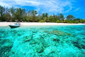
The largest of the three islands, Gili Trawangan attracts the majority of visitors, it is around thirty minutes boat ride from the northwest mainland of Lombok and regular daily fast boats depart Bali directly to Trawangan islandand all boats stop off at Teluk Nare on mainland Lombok as part of the return journey.

  • Digg
  • Del.icio.us
  • StumbleUpon
  • Reddit
  • RSS

read comments


Wayag Island is one of the islands within the Raja Ampat district in the province of West Papua. The island is known for its beautiful atolls and amazing underwater life covering a total area of 155,000 hectares (about 383,013.3 acres).
Here, you find pristine beaches with unique Karst islands that look like mushrooms sprouting out from the sea. Along these beaches, tourists can see fairy tale panorama, more captivating than Leonardo DiCaprio’s getaway in “The Beach”. The crystal clear waters around Wayag Island appear like unreal windows to various types of flora and fauna that live underwater.

  • Digg
  • Del.icio.us
  • StumbleUpon
  • Reddit
  • RSS

read comments


Overview

At 3,195 meters above sea level, Mount Dempo is the highest mountain in South Sumatra. Along with Mount Marapi on Sumatra, (not to be confused with Mt. Merapi in Central Java),  Mt. Dempo is the highest peak in the Bukit Barisan mountain range that stretches along the entire island of Sumatra, forming tis backbone. After sipping a cup of hot sweet tea in the cool dawn, listening to birds chirp in the trees and watching the  sun slowly rising on the horizon,  this is the perfect morning to hike up to the top of Mount Dempo
Located right on the border between the provinces of South Sumatra and Bengkulu on Sumatra’s west coast, Mount Dempo lies in the district called Pagar Alam.  And, as the name implies, Pagar Alam, meaning nature’s fence, is entirely surrounded by hills and mountain ridges. It takes some 7-hours driving to reachPagar Alam from Palembang, and then another 15 kilometers from the center ofPagar Alam to Mount Dempo itself. The trip will not be dull, since you will be presented with fantastic scenery of cliffs and valleys accompanied by fresh, unpolluted air. A vast tea plantation greets you as Mount Dempo comes into view: Here is the source of the energizing cup of tea.

  • Digg
  • Del.icio.us
  • StumbleUpon
  • Reddit
  • RSS

read comments


The mighty Rinjani mountain of Gunung Rinjani is a massive volcano which towers over the island of Lombok. A climb 
to the top is one of the most exhilarating experiences you can have in Indonesia. At 3,726 meters tall, Gunung Rinjani is the second highest mountain in Indonesia. The climb to the top may not be easy but it’s worth it, and is widely regarded as one of the best views in the country. 
Part of the famous ‘ring of fire’ this mountain also holds spiritual significance for the local people. It’s thought that the name Rinjani comes from an old Javanese term for ‘God’. 
Around the slopes of Rinjani there are lush forests sprinkled with waterfalls and surrounded by stunning scenery. 
Within the mountain is a crescent shaped lake, the breathtaking Segara Anak which is about 6km across at its widest point. This lake of sulfur is located 600 meters below the crater rim. Rising from the waters of this lake is a new volcano, Mt. Baru, which is a result of a series of eruptions during the 1990’s. Segara Anak is a spiritual place. The Balinese come here each year and perform a ceremony called pekelan where jewelry is placed in the lake as an offering to the mountain spirit.  The Wetu Telu people also regard the lake as holy and come here to pray on full moon nights. 
Mt Rinjani lies within the Gunung Rinjani National Park. The park covers 41,330 hectares and sits inside a major bio-geographical transition zone (Wallacea). This is where the tropical flora and fauna of South East Asia meets that of Australasia. This National Park was established in 1997 and is one of over 40 throughout Indonesia.
For visitors, the three-day Rinjani trek route from Senaru to the crater rim, down to the Crater Lake then on to Sembalun Lawang, is considered one of the best treks in South East Asia. More adventurous trekkers may want to head all the way to the summit of the volcano.  This is best reached from Sembalun Lawang and takes four days, finishing up in Senaru. 

  • Digg
  • Del.icio.us
  • StumbleUpon
  • Reddit
  • RSS

read comments